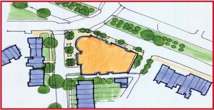
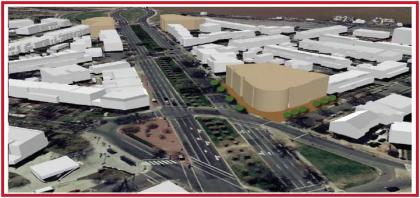
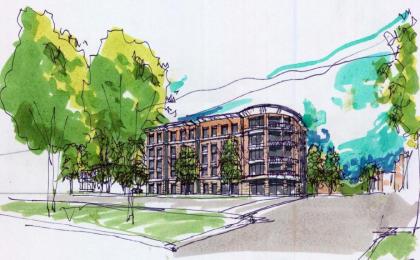
July’s issue of the Hill Rag contains some interesting tidbits in their ANC 6B beat report about a potential reconfiguration of the traffic patterns at the intersection of Potomac and Pennsylvania Avenues in Southeast Capitol Hill. Talks of reconfiguring Penn. Ave’s course through Capitol Hill seems to be in the news a lot these days, with Greater Greater Washington talking about the process going on just up the road around Eastern Market.
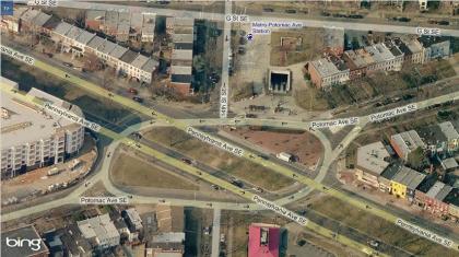
(Bing Maps aerial oblique of the intersection.)
DDOT’s proposal for the intersection is to merge the three existing traffic islands in the current ‘square’ while re-routing Pennsylvania’s traffic flow around the perimeter of the square. DDOT’s presentation showed two potential plans for remaking the intersection – one from the Middle Anacostia Crossings plan, and their preferred alternative.
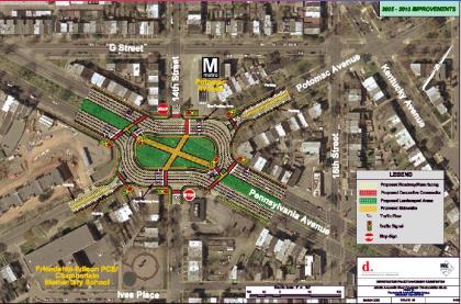
(MAC Plan)
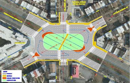
(Preferred Alternative)
The one key difference between the initial MAC plan from 2005 and the preferred alternative is the elimination of the east-west crosswalk through the square. The initial plan called for pedestrians to be able to access the square while standing in the median of Pennsylvania Avenue. This element was dropped from the preferred alternative.
The Hill Rag’s reporting made it seem that the ANC commissioners did not take kindly to the options presented:
While the commissioners and audience members didn’t seem to particularly enjoy the current layout, DDOT’s plan was universally panned for a number of reasons. One woman who lives near the intersection said the plan doesn’t go far enough to increase pedestrian safety, and she urged DDOT to consider installing a traffic camera in the area to cut down on driving violations. Another woman said that creating a traffic circle would obstruct the view of the Capitol building for drivers heading west on Pennsylvania Avenue.
Commissioner Carol Green said that the plan was unreasonable because it would prevent pedestrians from directly crossing Pennsylvania Avenue at the intersection.
“There’s going to have to be some way for them to cross without going a block out of their way, because that’s essentially what you’re asking them to do right here,” she said. “I can tell you for sure, they’re not going to do it.”
Commissioners voiced frustration when it became clear that the DDOT proposal was the only plan on the table right now. If the upcoming public comment period reveals that the community mainly objects to the plan, the entire planning process would need to start over and the project would be delayed for several years.
I’m not sure any of these criticims have any merit. Taking them in order:
Traffic cameras. These kinds of programatic elements are kind of beside the point when discussing major design decisions. By forcing Penn Ave traffic to make a turn, it will naturally slow things down. Traffic law enforcement strategies are a separate issue.
Obstructed views for drivers. Give me a freaking break. Drivers will have a completely unobstructed view of the Capitol Dome on the blocks preceeding and following this square on their way into town. By reconfiguring the public space here, may pedestrians might get some of that view, too.
Prevention of directly crossing Pennsylvania. I have no idea what Carol Green is talking about here. I live nearby and have crossed this intersection many times, and either of the proposed changes would make it far easier to get across Pennsylvania. The new square will make it much easier to traverse up and down 14th street, as you now only have to cross two streets to do so, whereas before you have to cross four. Furthermore, there’s more than enough evidence on the ground of ‘choice paths’ worn into the Pennsylvania median strip from jaywalkers cutting directly across:
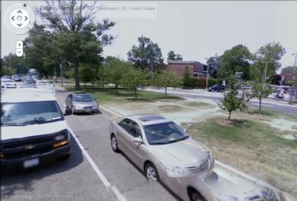
(Image from Google Maps Streetview)
Looking at either plan, I can’t see any scenario in which a pedestrian crossing Pennsylvania will have to go a block out of their way. Perhaps Comissioner Green was referring to people travelling along Pennsylvania rather than trying to cross it. It’s true that these Pedestrians will now have to walk a short distance around the square, but in that instance they wouldn’t save any time by walking in the street – as they would simply be walking through traffic, rather than the current practice of jaywalking to get across. Even so, a few rough calculations from the aerial maps show that a Pedestrian traveling on the southern side of Pennsylvania Ave would have to walk an extra 70 feet (~400 ft vs. ~330 ft) to cross from one side of the square to the other. When presented with reasonable alternatives, as we see from various other squares and circles in DC, pedestrians will take them.
All things considered, I fail to see what the commissioners are concerned about. This concept takes the current arrangment of public space and prioritizes pedestrians over cars. I’d prefer to see the iteration from the MAC plan, making this square a more accessible place with four crosswalks rather than two, but the general concept is solid. Jaywalking at this intersection is rampant. It’s both a safety hazard and an indicator of a poorly designed space.
On the other hand, the opportunity to vastly improve the safety of this intersection, as well as provide a new public space for the neighborhood is too great to simply dismiss.


