Category Archives: Uncategorized

Miscellanea

Wonder Woman wants streetcarsAwesome.

Unintended Consequences. Discovering Urbanism (cross posted on GGW) notes how well-intentioned regulations on reducing stormwater runoff can have some seriously counter-productive consequences.

Sometimes genuinely smart and well-intentioned people err by focusing intently on the piece of the puzzle they have been commissioned to solve, thereby missing the larger system within which their problem is embedded. It’s the classic widen-the-freeway-to-reduce-congestion scenario. It may solve the technical problem at hand, but it exacerbates the Real Problem.

It’s Gold, Jerry!  Gold! The Transport Politic notes an interesting conversation about upgrading part of the current Metra Electric line to better integrate with the CTA’s rail facilities.  This line would then be dubbed the “Gold Line,” a not-so-subtle nod to future events in the area,  given the line’s proximity to a number of the planned Olympic facilities for Chicago’s 2016 bid.  Regardless of Olympic facilities, this seems like a great idea – quite frankly, something that should have been done a long time ago.

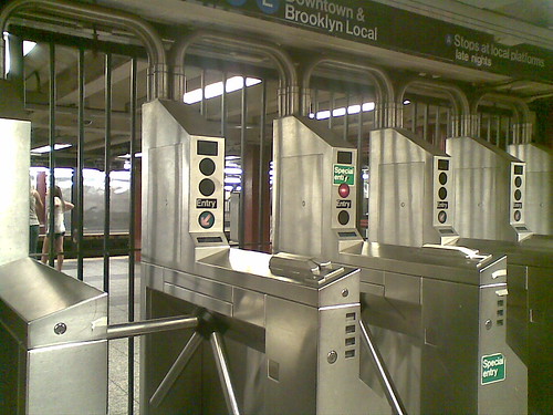
The Gold Line plan would attempt to solve some of those problems by converting parts of the Metra Electric line, which runs from Millenium Station downtown south along the waterfront, to CTA operation at a cost of $160 million. This would require new faregates, 26 more train cars, and several track and station upgrades. The project would also include the creation of a new station at 35th Street in Bronzeville. While the service would continue to be operated by Metra, customers would ride the trains as if they were CTA-owned, and they would be able to transfer without extra cost to CTA buses and rapid transit.

Most importantly for people living along the lakefront, trains would now run at maximum 10-minute frequencies from 6 am to midnight, ensuring that the system is reliable at most hours. Trains on the Electric Line currently run once an hour during off-peak times, making it hardly an option for people who need to get around the city during the day. The same service options are offered on most of the Metra network.

Those familiar with the Metra Electric line know that it’s already got a more rapid-transit like structure through the south side, with stations spaced much closer together.  This is the perfect case to show what integration of the rider experience across modes could do.  My one question is why limit it to just a portion of the Metra Electric line?  Why not pursue this kind of upgrade to the entirety of the line?

STEEM Powered Streetcars? Alstom has yet another entry into the catenary-free streetcar operations.  Such technology would be great for DC, given DC’s ban on overhead wires.  Still, it’s not easy to be an early adopter of these kinds of things.

If implemented, Alstom’s new STEEM system*, on the other hand, will require less catenary wire and no underground construction; it simply requires the upgrading of existing tram vehicles. Trains will be equipped with large batteries connected to their motors that will be charged each time the vehicle brakes, much like the way a Toyota Prius hybrid refills its battery. In addition, the trams will be able to benefit from charging during 20-second station dwell times, where trains will benefit from a catenary; theoretically, the system wouldn’t require the use of the catenary between stations.

There’s also one big sticking point:

Alstom’s technology is not yet advanced yet to work on fast-moving American light rail systems, which typically have station stops up to a mile apart, likely too far for its battery capacity to handle. Whether the system can handle the incredible wastefulness of air conditioning — something not present in Paris — is a different question. But it could be particularly useful for streetcar networks, such as the one planned in Washington, D.C., where a congressional ban on overhead wires is still in effect — something that could likely be circumvented if the wires were only present at stations. In cities like Portland where light rail stations downtown are just blocks apart, the technology could mean the ability to get rid of overhead wires in central sections of the network.

Yeah, such a system better be able to handle A/C.  I like to keep my transit usage and sauna visits separate.

Parking Shmarking. Richard Layman was in attendance at a recent meeting on keeping 7th St SE near the newly-reopened Eastern Market closed during the weekends.  This is a great idea, only opposed by a few merchants who overvalue the parking spaces in the area – and don’t have a great understanding of the value of a space versus the turnover of that space.   Those parking spaces don’t do your business any good if someone’s car is just sitting in it all day.  That’s not going to get you more customers.

For Sale.  CHEAP. If you can find it.

Political FAIL. The answer is staring us in the face.

BeyondDC  is considering a new career editing articles for clarity and accuracy.

Canopies

(Image by Kyle Walton on Flickr)

Most of Metro’s station entrances these days have canopies to protect patrons and escalators from the elements.  It wasn’t meant to be this way, as Zach Schrag documents in his book The Great Society Subway.  For numerous reasons, however, we have them now.  With that in mind, DC Metrocentric has a recent post up on the elegance of the canopies at Columbia Heights – how they blend in to the surrounding area, fit well with the nearby architecture, etc.

I can’t help but comment on these canopies – because I really dislike the Columbia Heights (and Petworth, for that matter) canopies.   Unlike the other canopies in the system, these ones may look fine from the outside, but they violate a number of the basic design precepts of the entire system.  There’s something to be said for individualized stations and station entrances, but for better or for worse that’s not part of the Metro system.  Instead, Metro is marked by remarkable continuity between stations with common design elements and common materials.

One of those core principles is to maximize volume. This isn’t just for grandeur, either – the voluminous train rooms in Metro’s underground stations provide clear sight lines for patrons to see the mezzanines and easily visualize the circulation routes to get in and out of the stations.  Similarly, Metro designers explicitly wanted to stay away from associations with older, enclosed systems in Philly, Boston, Chicago and New York – that meant fare gates are unobtrusive, unlike their caged cousins in New York.

The Columbia Heights canopies violate a couple of these points.  Though they enclose a lot of space, they sure don’t feel voluminous.  Because the canopies sit rather low on the station’s parapet, the gap between the outside and the escalator shaft feels enclosed.  It doesn’t help that the gap is enclosed with a combination of public art and metal bars.  It feels more like a cage than a canopy.

(Image by dbking on Flickr)

Where older metro entrances have their ‘doors’ and gates used to close the system at the bottom of their escalator wells, these stations have them at the top of the escalators as part of the canopy.  This necessitates the caged feeling, since it functionally is a cage.  Undoubtedly, this is done to eliminate homeless people sleeping at the bottom of the escalators but the effect is detrimental to the overall design.

Finally, these canopies don’t identify which part of the structure is the entrance.  This isn’t a huge critique, because the canopy-less stations have the same problem.  However, given the fact that the canopies do exist, the more common design does a much better job of identifying where to enter the system simply by design.

(Image by dbking on Flickr)

The soaring canopy fits Metro’s design much better.  It provides the necessary shelter for both people and equipment, maintains the openness of the station entrances, clearly indicates where one enters the station, and harmonizes well with the rest of the system’s architecture.   The ‘scooping’ of the canopy clearly indicates which end is the entrance.  The curvature of the canopy, combined with the individual panes of glass evokes a clear parallel to the original coffered vault station design.

For freestanding station entrances, this is the better option.

However, they’re not a cure all.  The U Street Metro’s 13th Street entrance is a great example.

Here, the canopy ‘opens’ to a wall.  Not so good.  Perhaps a better option would have been to integrate the station entrance into the structure itself, as is done quite successfully in several downtown stations.  This also would have been a viable option for the Columbia Heights stations and might be a more functional way to achieve the individuality for each station that DC Metrocentric wants.   Not every entrance should be a grand plaza.  It works in some spaces (like Eastern Market, where the plaza is already there), but in others it can be detrimental.  Potomac Ave is a great example – there’s plenty of open space in the adjacent square that could be far better utilized.  The plaza around the station itself is underutilized.  If the land could be developed and the station accessed via a ‘retail’ storefront kind of entrance, the station area itself would gain density and uses, as well as improvements to the urban deisgn of the area.

Links – Harumph.

The Urbanophile makes no little plans with a nice review and synopsis of transportation’s role in Daniel Burnham’s famous Plan of Chicago.   As someone born and raised in the Midwest, I’ve got a soft spot in my heart for Chicago.

His “City Beautiful” movement can also easily be read as a precursor to urban renewal. Indeed, a good chunk of his plan consists of Robert Moses like street building and street widening projects, many of which were in fact carried out. And he drew direct inspiration, and even claimed inspiration in the document itself, from Hausmann’s bulldozing of the Paris to construct the grand boulevards there.

On the other hand, writing in 1909 he can perhaps be forgiven feeling overly optimistic about the automobile, and the more humane side Burnham shows through in many places as well. So let’s take a look.

Given DC’s abundance of very wide streets, widening them isn’t reason alone for a bad plan.  Indeed, many of Burnham’s widened streets, even if the goal was to better accommodate the car, function today as grand avenues.  Michigan Avenue in particular comes to mind.  Moses, on the other hand, brought in expressways.  What a difference 30-40 years makes in both the evolution of the automobile, as well as the evolution of road design.

Lake Shore Drive has a more mixed legacy – it’s definitely more in the “parkway” mold of Moses’ freeways, but other elements of the plan (such as the double decker streets downtown) are functional for both cars and pedestrians alike.  Wacker Drive not only provides great backdrops for the Blues Brothers and Batman, but it’s a fine public space as well.

Another relevant note and similarity Chicago shares with DC:

“The greatest disfigurement of the residence street is found in the varied assortment of poles which crowd out the trees along the space between the curb and the sidewalk.”

One thing that cannot help but strike any visitor to Chicago is the near complete absence of utility poles apart from street light standards on streets. And not just residential streets, but commercial streets. This is extremely rare in the United States. Chicago has more alleys than any city in America, and its power, telephone, and cable lines are located there. (As is its trash – take that, New York!).

Amen.  It’s just too bad that DC’s overly restrictive legislation against overhead wires inhibits development of streetcar networks, etc.

Chicago is a huge city, but it often doesn’t feel that way. Get out of the core and you find streets full of mature trees and greenery exceeding that found in much smaller places. This is no concrete jungle. It is a city for people.

As someone who grew up in the Midwest, Chicago always felt like the “big city,” but was definitely still Midwestern in vibe.  It’s a truly remarkable city, and this observation is spot on.  The neighborhoods feel welcoming and fit in to the larger city like lock and key.  It’s a similar feeling I got upon arriving in DC.  My previous experience had been almost totally federal, without any real exploration of DC’s neighborhoods.

The only real parallel is that DC never has (to me) that same kind of Big City feel that Chicago does – but much of that is due to Chicago’s dominance over its region.  Nevertheless, it’s a great place to visit.

Thank you sir, may I have another! Randal O’Toole continues to get lambasted amongst the pro-urban bloggers.  The Overhead Wire weighs in on Ed Glaeser’s op-ed piece – comparing it to O’Toole’s work (for someone of Glaeser’s accomplishment, that’s not a compliment), and Ryan Avent takes a shot at O’Toole’s recent testimony before Congress:

The performance earned dismal reviews. One by one, the other witnesses pointed out that failure to adequately examine land use effects rendered O’Toole’s analyses worthless.

Mode choice isn’t just about direct energy use, they explained; it’s about how increased driving or transit use affects development patterns and broader economic activity. Moreover, increased transit use improves the efficiency of driving by reducing congestion.

It’s great to see O’Toole’s ‘analysis’ get this kind of treatment not just from bloggers but from the fellow panelists as well (and even a Senator or two).

O’Toole was without friends in a room of leaders that finally seemed to grasp how planning had gone wrong in the last half century. At this moment — with vehicle miles traveled falling, with central city population growth rates increasing as suburban growth rates fall, and with central city housing prices showing resilience as exurban neighborhoods continue to experience rapid decline — Cato’s myth of sprawl as the American dream seems more hollow than ever.

Happily, legislators — at least those who attended today’s hearing — increasingly seem disposed to acknowledge reality.

That’s great.  Now, about turning that thought into action…

Maps. GGW and BDC have a couple of posts on GGW’s publication of several MWCOG maps of home locations of employees based on where they work.  The patterns are quite interesting, showing how people tend to cluster their homes nearby their place of employment, regardless of transport mode.  Thus, for employees in DC’s downtown Federal buildings, their home choices are located around Metro.  NIH employees tend to congregate on the Wisconsin Ave/Rockville Pike corridor, etc. Similarly, suburban job centers like Reston still show a great deal of concentration, but not nearly as tight as the transit-oriented locations.

BDC’s policy takeaway:

Think those downtown workers are the ones clogging I-66 and I-95? Not likely. The situation could not be more clear: If you want to foster Smart Growth and multi-modalism, put your jobs in the city. If you want to foster sprawl and congestion, put them far away. End of story.

I would add that within our current framework of transit corridors and job centers, continuing to try and transform an area like Tysons Corner into more of a city is worthwhile.  However, consider the rest of Tyson’s Silver Line neighbors – transforming the Dulles Corridor into something more like Rosslyn-Ballston well after the fact is going to be easier said than done.  We don’t have much choice but to try, but running a subway down the median of a freeway isn’t going to produce the best results.

Random Stuff:

  • Austin Contrarian looks at the relationship between the skill level of employees in cities and the density of that city.  Bottom line – more dense, more skilled – and the relationship is particularly strong when you look more at the weighted density of an area.
  • Housing Complex looks at the plans for Rhode Island Ave, starting with some woefully underutilized land near one of the original 1976 Metro stations.   Fun facts to know and tell – Brentwood has the highest elevation of any station in the system.
  • Metro operators probably shouldn’t be texting while driving.

A New Square for Potomac Ave – Part II

Following up on the vision for the public space at the Potomac Ave Metro station, I wanted to offer a glimpse at what the square might look like in the future.  All of the great squares, circles, and other urban spaces are not just defined by their public spaces, but also by the buildings that frame the space.  With the addition of Jenkins Row to this intersection, Potomac Ave is approaching both a complete streetwall around the square, as well as the critical mass of various neighborhood services.

With that in mind, I turn to the draft of the Pennsylvania Avenue SE Land Development Plan.  Of specific interest for this intersection is the Potomac Ave sub-area plan.  This iteration identifies the 1401 Pennsylvania parcell as a key redevelopment opportunity.  A quick glance at the area will quickly identify the SE corner of the square as the weak link, containing a couple of vacant lots, a parking lot, and New York Pizza.  Living in the area, I love what NY Pizza brings to the ‘hood, so I would sure hope that any redevelopment helps them find a new home.  Even so, you can totally tell it used to be a Pizza Hut.

With Jenkins Row filling in the old gap on the eastern edge of the square, this parcel is the one missing link (aside from the Metro station plaza).  As such, the plan calls for new mixed-use construction at the side in the same mold as the Jenkins Row development – first floor retail with office and/or residential above.

Potomac Ave Plan

(Plan view)

Potomac Ave Massing

(Massing perspective)

Potomac Ave Sketch

(Concept sketch)

A couple of points stand out.  First, when combined with the reconfiguration of the intersection’s traffic flow, buildings fronting on the new square ought to see more foot traffic – at a very least, the sidewalks they front on should be far more attractive to pedestrians walking either around the square or passing through it.

Second, the current Metro plaza, as mentioned above, would then be the one missing part of the streetwall enclosing this square.  Given that the station is such a focus for foot traffic, this is fine – but one potential benefit is that a taller structure on the 1401 site is directly in the line of sight of Metro patrons coming out of the station’s escalator well.

All together, such a project could be the keystone in the arch for this public space.  As of right now, I’m unaware of any specific plans for the site.  I’ll just enjoy my pizza until then.

But seriously, if this site does get developed soon, you gotta keep the pizza.

Links – Mono…D’OH!

With apologies to Lyle Lanley, it’s worth reporting that Disney’s genuine, bonafide, electrified, six car monorail! crashed.  Is there a chance the track could bend?

The Transport Politic notes the damage this kind of fantasy has on useful transit advocacy.   The Simpsons really does the same thing, when you think about it.

But the fact that more Americans have probably ridden the Walt Disney monorail systems than have chosen to take advantage of their local transit offerings is problematic. That’s because Disney presents a space-age vision for what public transportation should be, and it’s that fantasy that many Americans want in their trains and buses, not the mundane services like light rail and buses that most communities can actually implement. Meanwhile, Disney can offer the convenience of rapid transit in a safe, well-monitored environment, something difficult to do day-in, day-out in a real city.

The most damaging effect of the Disney monorail is the pervasive idea among virtually everyone other than transportation people that it represents the ultimate in transit technology. That’s why cries for “monorails!” come up at every turn when communities consider new transportation systems, even though monorails are consistently more expensive and less reliable than their two-track counterparts. It’s a mystery why people find the idea of the single, elevated track so exciting, but Disney’s example may be one explanation.

That Simpsons episode looks more and more prescient.  “…but Main Street’s still all cracked and broken!”

Avent vs. Glaeser. Ryan Avent takes Ed Glaeser’s recent Op-Ed on high speed rail to task over at Streetsblog.

Glaeser is correct that a good place to begin addressing our transportation failures is by pricing congested highway and air routes more effectively.

But we have every indication that doing so would significantly increase demand for rail services, while also raising tens of billions of dollars every year that could be used to construct a rail system that would be cleaner and faster than driving or flying. Contra Glaeser, pricing our existing infrastructure would make it painfully clear just how badly we need an effective intercity rail system.

In environmental and economic terms, the case for major investment in high-speed rail is quite strong. Unfortunately, wisdom seems to take wing whenever economists start writing about public spending.

Indeed.  Others take the social aspects of Glaeser’s proposition.  Any way you slice it, it’s pretty clear that Glaeser’s pop economics doesn’t do much in persuading the transportation blogosphere.

NIMBY’s Aren’t Environmentalists. The East Bay Express has a great piece on the role of cities and density in the environmentalism.  It’s a lengthy piece, but well worth the read.   The article makes several key points about how conventional thinking about managing urban growth, even with explicit intentions to be environmentally friendly, or to be affordable, often hurts the overall outcome.   Most importantly, the fight against density in developed, transit accessible areas is a major impediment to sustainable urbanism.

When put into a DC context, the article raises several key points about building heights.

Much of the heated debate over the plan has been about tall buildings. After eighteen months of meetings, a city-sponsored committee recommended that the council allow four 100-foot-tall buildings, and four that are 120 feet tall in the downtown area. However, the city’s planning commission, which is more development friendly, came up with its own plan that would allow six 120-foot-tall buildings, and four that are 180 feet tall — as tall as the existing Wells Fargo building, the city’s tallest. Both plans would also allow most new buildings to be built at a maximum height of 85 feet. The council appears to be leaning toward approving the denser plan, which some critics decry as “the Manhattanization of Berkeley.”

Hmmmm.  Where have I heard those arguments before?

In truth, the fight over building heights is misdirected. Tall buildings are unlikely to be built in Berkeley anytime soon because they’re too expensive to construct. The real difference between the two plans is that the less dense one will probably result in no tall buildings, while the other will probably produce four. The reason is that developers prefer buildings that are less than 75 feet tall or greater than 180 feet, but not in between. So any plan that calls for 100-foot- or 120-foot-tall buildings is unrealistic.

Why? In buildings that are less than 75 feet tall, developers can use wood framing, which tends to be relatively inexpensive. But above that height, fire-safety codes require them to build with reinforced concrete or steel, which costs a lot more. As a result, developers can’t make a tall building profitable unless it’s at least 180 feet in height (seventeen stories). Anything shorter than that means that the developer won’t generate enough money from selling condos or renting apartments to pay for the high costs of erecting the building in the first place.

Of course, with land values as high as those in Downtown DC, you can easily justify going as high as possible – even though those heights fall within that ‘unrealistic’ zone of 100-120 foot tall structures.

Oakland could achieve plenty of density with 75-foot-tall housing developments, Pyatok argued. Assuming that such buildings can house about 150 people per square acre of buildable space, that works out to about 96,000 residents per square mile. As a reference, Manhattan is home to about 65,000 people per square mile. “It’s just a misunderstanding to think that you have to have high-rises to get high density,” said Pyatok, who also has been studying the potential growth of Upper Broadway with a group of graduate students. “I really think that a 75-foot height limit throughout a great deal of downtown could create a lot of density.”

This is more or less the situation we see in a lot of DC, at least with regard to the height limit (and therefore upper cap on density).  What’s missing, of course, is that most of DC’s areas built to max height are office districts, not residential ones.  Fear not, however – there are solutions to this, as well:

Oakland, he believes, should limit skyscrapers to Broadway, near the 12th Street and 19th Street BART stations. Or, he said, the city should take a hard look at what San Francisco and other cities have done. San Francisco limits both building density and height, but allows property owners to buy and sell development rights to construct skyscrapers. So if you’re a property owner and you do not intend to build a high-rise, then you can sell the space above your building to another developer, who then can add it to his or her property and build taller. As a result, San Francisco has been able to protect historic buildings while controlling land values and spurring growth.

For DC, a transfer of development rights program to encourage the sale of density rights from areas worth protecting (whether they be existing rowhouse neighborhoods or the height-capped and very high value downtown) and transferring them to a designated receiving zone could be a framework to grow the city around in the future.  Designating a few receiving areas, such as Poplar Point, would allow some taller buildings (perhaps eclipsing that dead zone where building up doesn’t make economic sense) to give DC a high rise district similar to what we see in Rosslyn, Silver Spring, and Bethesda.  Doing so with a TDR program would continue to encourage infill development and densification within the city while still allowing an outlet for development pressures in areas of the city we wish to protect.

With any such plan, of couse, the devil’s in the details – but it’s certainly worth considering, in my mind.

Links – Stimulus Package

Paul Krugman takes note of Joe Biden’s recently souring perceptions of the economy, as well as the fact that it appears another stimulus package would be a nice boost right about now:

But never mind the hoocoodanodes and ayatollahyaseaux. What’s important now is that we don’t compound the understimulus mistake by adopting what Biden seems to be proposing — namely, a wait and see approach. Fiscal stimulus takes time. If we wait to see whether round one did the trick, round two won’t have much chance of doing a lot of good before late 2010 or beyond.

So, we have to spend money right now.  Hmmmmm.  If only we had something in this country that needed lots and lots of money…

There’s a power drain out there at the NSA.  Apparently those code-breaking supercomputers require a whole lot of juice.  Aside from the security reasons for decentralizing operations like this (which is certainly not a new idea amongst the Feds), it’s an interesting idea to think about the consequences of decentralizing more ‘abstract’ facilities like data centers while still opening the door for centralization of personnel and employment.

They put a price on congestion in New York.  Charles Kamonoff pegs it at $160 per trip.  Felix Salmon’s early conclusion:

Komanoff’s still working on this spreadsheet, but tHe main message is pretty clear — that smart congestion charging would be great news for New York, and probably for most other dense cities as well.

AC chimes in as well:

The basic point is sound:  we severely underestimate how many people we delay when we enter a congested network of roads.  If you’ve ever tried to make the trip crosstown Manhattan in the middle of the day, you understand just how much delay one driver can cause.

Komanoff recommends congestion pricing.  A good idea.  But he also proposes making buses free, which is a bad idea (and one floated in Austin occasionally).

I tend to agree that completely free transit is a bad idea.  We have congestion on our system in DC as it is at the peak hours.  There’s something to be said for the psychology behind charging a nominal fee for a service.

A New Square for Potomac Ave

July’s issue of the Hill Rag contains some interesting tidbits in their ANC 6B beat report about a potential reconfiguration of the traffic patterns at the intersection of Potomac and Pennsylvania Avenues in Southeast Capitol Hill.  Talks of reconfiguring Penn. Ave’s course through Capitol Hill seems to be in the news a lot these days, with Greater Greater Washington talking about the process going on just up the road around Eastern Market.

Potomac Ave

(Bing Maps aerial oblique of the intersection.)

DDOT’s proposal for the intersection is to merge the three existing traffic islands in the current ‘square’ while re-routing Pennsylvania’s traffic flow around the perimeter of the square.  DDOT’s presentation showed two potential plans for remaking the intersection – one from the Middle Anacostia Crossings plan, and their preferred alternative.

Potomac Ave MAC plan

(MAC Plan)

Potomac Ave Preferred Alt

(Preferred Alternative)

The one key difference between the initial MAC plan from 2005 and the preferred alternative is the elimination of the east-west crosswalk through the square.  The initial plan called for pedestrians to be able to access the square while standing in the median of Pennsylvania Avenue.  This element was dropped from the preferred alternative.

The Hill Rag’s reporting made it seem that the ANC commissioners did not take kindly to the options presented:

While the commissioners and audience members didn’t seem to particularly enjoy the current layout, DDOT’s plan was universally panned for a number of reasons. One woman who lives near the intersection said the plan doesn’t go far enough to increase pedestrian safety, and she urged DDOT to consider installing a traffic camera in the area to cut down on driving violations. Another woman said that creating a traffic circle would obstruct the view of the Capitol building for drivers heading west on Pennsylvania Avenue.

Commissioner Carol Green said that the plan was unreasonable because it would prevent pedestrians from directly crossing Pennsylvania Avenue at the intersection.

“There’s going to have to be some way for them to cross without going a block out of their way, because that’s essentially what you’re asking them to do right here,” she said. “I can tell you for sure, they’re not going to do it.”

Commissioners voiced frustration when it became clear that the DDOT proposal was the only plan on the table right now. If the upcoming public comment period reveals that the community mainly objects to the plan, the entire planning process would need to start over and the project would be delayed for several years.

I’m not sure any of these criticims have any merit. Taking them in order:

Traffic cameras. These kinds of programatic elements are kind of beside the point when discussing major design decisions.  By forcing Penn Ave traffic to make a turn, it will naturally slow things down.  Traffic law enforcement strategies are a separate issue.

Obstructed views for drivers. Give me a freaking break.  Drivers will have a completely unobstructed view of the Capitol Dome on the blocks preceeding and following this square on their way into town.  By reconfiguring the public space here, may pedestrians might get some of that view, too.

Prevention of directly crossing Pennsylvania. I have no idea what Carol Green is talking about here.  I live nearby and have crossed this intersection many times, and either of the proposed changes would make it far easier to get across Pennsylvania.   The new square will make it much easier to traverse up and down 14th street, as you now only have to cross two streets to do so, whereas before you have to cross four.  Furthermore, there’s more than enough evidence on the ground of  ‘choice paths’ worn into the Pennsylvania median strip from jaywalkers cutting directly across:

Potomac Ave streetview

(Image from Google Maps Streetview)

Looking at either plan, I can’t see any scenario in which a pedestrian crossing Pennsylvania will have to go a block out of their way.  Perhaps Comissioner Green was referring to people travelling along Pennsylvania rather than trying to cross it.  It’s true that these Pedestrians will now have to walk a short distance around the square, but in that instance they wouldn’t save any time by walking in the street – as they would simply be walking through traffic, rather than the current practice of jaywalking to get across.  Even so, a few rough calculations from the aerial maps show that a Pedestrian traveling on the southern side of Pennsylvania Ave would have to walk an extra 70 feet (~400 ft vs. ~330 ft) to cross from one side of the square to the other. When presented with reasonable alternatives, as we see from various other squares and circles in DC, pedestrians will take them.

All things considered, I fail to see what the commissioners are concerned about.  This concept takes the current arrangment of public space and prioritizes pedestrians over cars.  I’d prefer to see the iteration from the MAC plan, making this square a more accessible place with four crosswalks rather than two, but the general concept is solid.  Jaywalking at this intersection is rampant.  It’s both a safety hazard and an indicator of a poorly designed space.

On the other hand, the opportunity to vastly improve the safety of this intersection, as well as provide a new public space for the neighborhood is too great to simply dismiss.

Man Bites Dog

Freakonomics had a nice post about the media coverage of Metro’s recent crash, drawing parallels with airline crashes and the perception about the safety of these various transport modes:

But what the media very rarely mention is that the carnage on our roads makes these much-hyped accidents look almost trivial. Nine lives is nine too many, but there were 39,800 motor vehicle traffic fatalities in 2008 alone (and that was a good year). At that rate, between the time of the accident, June 22, and the time you are reading this, on average about 1,000 Americans died on our roadways. Yet this rarely merits a mention by the press.

And I think there is one more key dynamic. Heavy rail (the mode in the Washington crash) is a lot safer than car travel; in 2006 (the last year for which I have data) autos were responsible for five times more fatalities per passenger mile. (See here for auto fatalities per year, here for transit fatalities, and here for passenger miles traveled by mode.

In 2007 and 2008 there was not a single fatal accident associated with a major commercial airline. This year has seen 60 deaths (most from a single crash), but that still makes commercial air travel vastly safer than driving. Even in 2001, the year of a (hopefully) freak disaster on 9/11, commercial air travel had a per-passenger mile fatality rate about one eighth that of driving (see here for air fatalities).

Matt Yglesias had a similar feeling in the immediate aftermath:

— Fatal train accidents are national news stories precisely because they’re so rare. Deadly car crashes are a dog-bites-man story. Obviously, what happened was unacceptable but the fact remains that commuting by rail is very safe.

So far, I’ve been very impressed with the man on the street interviews most local TV stations have had with Metro riders.  Almost all of them have expressed this exact same sentiment – despite the accident, Metro is still the safest way to travel.

My anecdotal evidence from riding shows very few people have been avoiding the system.  Yesterday’s ridership report (June 2) shows system-wide ridership of 778,670.  Considering the proximity to the long weekend, that’s exactly what you’d expect to see.  It’s down from last year’s number on that date, but gasoline last summer was a lot more expensive.

Fixed Gear Links

Berlin bans fixies.

Hipster cred might increase exponentially.

DC might limit the number of cabs?

I’m all for allowing the market to determine the number of cabs, but there’s something to be said for a medallion system that would do a better job of meeting a minimum level of quality and service.  I’ve been turned down by far too many cabs just trying to get back to Capitol Hill.

Also, these kinds of quotes don’t give me a lot of faith in the quality of our taxis:

Graham, whose committee oversees the taxicab industry, said the city has 8,000 licensed operators and 1,000 applicants who have passed the tests but have not completed the licensing process. That seems to be more licensed operators per capita than any other city in the world, he said: “This boat is going to sink by its own weight.”

The switch from zones to meters and the economy have hit the pockets of some cabdrivers. And competition isn’t helping.

Applicants have inundated the system since tests resumed last year; the city had stopped giving exams when questions were leaked. There was evidence of cheating in 2005.

Graham said he did not know how the city would achieve a cap on drivers but said one possibility is requiring medallions or certificates. He said the city also should reconsider whether to continue giving applicants three chances to pass the exam.

An old friend of mine was visiting from Boston a few weeks ago – the poor quality of our cabs was one of the first things he mentioned to me.

Obama offers a transportation counter-proposal, featuring some hints of what might be to come with an infrastructure bank.